What is Ground Penetrating Radar
Ground-penetrating radar, often abbreviated as GPR, is a non-destructive geophysical method that utilizes radar pulses to create an image of the subsurface. This technology employs electromagnetic radiation in the microwave band of the radio spectrum, typically in the ultra high frequency (UHF) or very high frequency (VHF) ranges. It captures the reflected signals from below the surface, thereby providing valuable insights into the underground structures.
The functioning of GPR is relatively straightforward. As the GPR antenna moves along the ground surface, it transmits a signal into the ground. When this signal encounters a boundary between two different materials, such as rock and soil, a part of the signal is reflected back to the antenna while the rest continues further into the ground. The time it takes for the reflected signals to return to the antenna is measured by the GPR system. This time measurement helps in estimating the depth of the boundary or object that caused the signal reflection.
The data captured by GPR is typically displayed as a cross-sectional or 2D image of the subsurface, showing variations in the material properties and anomalies. This allows for a detailed analysis of the underground structures without the need for drilling or excavation.
The versatility of GPR is reflected in its broad range of applications. It is widely used in fields like archaeology for locating and mapping buried artifacts or structures, in geology for subsurface mapping, in environmental studies for remediation, in military for detecting mines or tunnels, and in construction for locating utilities or conduits within concrete structures. Overall, GPR is an invaluable tool for studying the subsurface in a non-invasive and efficient manner.
How it Works?
Ground-penetrating radar (GPR) is a sophisticated tool that works by sending a tiny pulse of energy into a material via an antenna. It’s a nondestructive technique that uses electromagnetic radiation in the radio spectrum to detect reflected signals from subsurface structures. Here’s a more detailed step-by-step explanation of how GPR works:
- Transmission of Radio Waves: It all begins with the transmission of the high-frequency (usually polarized) radio waves into the ground or any other material from a radar antenna. This is essentially a concentrated beam of radio waves that is directed down into the ground.
- Travel of Radio Waves: The radio waves travel through the material under examination at a speed that is determined by the permittivity of the material. The permittivity is a measure of how much electric charge a material can store in an electric field. Generally, radio waves travel slower in denser materials and faster in less dense materials.
- Reflection of Radio Waves: As these waves encounter boundaries between different materials under the surface (because different materials have different electrical properties), some of the waves are reflected back to the surface, while the rest continue until they either dissipate or are reflected back from other boundaries deeper down.
- Receiving Reflected Waves: The antenna then receives the reflected waves and records the strength of the reflection and the time it took for the reflection to return. The time is essential as it helps in determining the depth of the boundary or object causing the reflection. This is based on the principle that radio waves travel at a constant speed in a given material, and the distance they travel is equal to the travel time multiplied by this speed.
- Data Processing: A computer attached to the GPR system processes these signals and produces a profile of the subsurface, usually displayed on a screen. This profile often appears as a continuous cross-sectional view that shows any subsurface variations or anomalies in the material being scanned.
- Interpretation: Geophysicists or other trained professionals then interpret the GPR data. The final interpretation involves understanding the type and location of objects or materials beneath the surface based on the strength and timing of the return signals. This can be anything from buried utilities and structures to changes in soil or rock properties, voids, cracks, or even archaeological artifacts.
Varieties of Ground Penetrating Radar
There are different types of ground-penetrating radar (GPR) systems, which can be categorized based on a few different factors:
Frequency: The frequency of the radar wave is a key parameter that determines the depth of penetration and the resolution of the GPR system. Lower frequencies (e.g., 100 MHz) provide deeper penetration but lower resolution, making them ideal for geological and environmental studies. Higher frequencies (e.g., 1000 MHz or 1 GHz) provide higher resolution but shallower penetration, suitable for structural investigations, like concrete inspection.
Configuration: GPR systems can have different configurations depending on the application:
- Hand-pushed or towed systems: These are commonly used for utility detection and concrete inspection. They are usually lightweight and portable, making them suitable for a range of field conditions.
- Vehicle-mounted systems: These systems allow for high-speed data collection over large areas and are often used in road inspection or geological mapping.
- Borehole systems: These GPR systems are designed to be lowered into a borehole to provide a high-resolution image of the subsurface strata and structures surrounding the borehole.
Single vs. Multiple Antennas: Some GPR systems have multiple antennas which can transmit and receive signals simultaneously, thereby increasing the speed and efficiency of data collection. For example, arrays of antennas can be used to cover larger areas in less time or to provide three-dimensional images of the subsurface.
Time- vs. Frequency-Domain: Most GPR systems operate in the time-domain, sending a pulse of energy into the ground and recording the time it takes for reflections to return. However, frequency-domain systems, which measure continuous wave signals of different frequencies, are also used in some applications.
The choice of GPR system depends on the specific requirements of the application, including the depth and resolution needed, the type of terrain, and the size of the area to be surveyed.
What is Ground Penetrating Radar Used for?
Ground-penetrating radar (GPR) has a wide range of uses in several industries due to its ability to provide high-resolution images of the subsurface in a nondestructive and noninvasive way. Here are some specific applications across various sectors:
- Geology: GPR can be used for mapping bedrock, determining depth to bedrock, mapping soil interfaces and water table levels, and for delineating sands, gravels, clay, and bedrock. It is also used for mineral exploration, mapping faults and fractures, and measuring soil moisture levels.
- Archaeology: GPR is frequently used in archaeological investigations to locate and map buried artifacts, structures, and features. It can help identify graves, foundations, walls, and other remnants without disturbing the site.
- Civil Engineering and Construction: GPR can detect and map subsurface utilities such as water pipes, gas lines, and communication and electrical cables. It is also used to inspect bridges, monuments, buildings, roads, runways, dams, and railway embankments. GPR can find rebar in concrete, locate post-tension cables, identify voids under slabs or behind walls, and measure slab thickness.
- Environmental Science: In environmental studies, GPR is used to identify and locate buried waste, drums, underground storage tanks, and landfills. It is also used to study soil and groundwater contamination, and map peat depths and permafrost.
- Military and Security: GPR can be used for detecting buried explosives, land mines, and tunnels, making it very useful in military, security, and humanitarian demining applications.
- Forensics: Forensic investigators use GPR to locate clandestine graves and buried evidence. It is also used in search and rescue operations, such as locating people trapped under collapsed buildings after natural disasters.
- Agriculture: GPR has been used to study soil structure, moisture content, and root detection, contributing to more efficient agricultural practices.
- Glaciology: In the field of glaciology, GPR is used to measure ice thickness, detect crevasses, and study the internal structure of glaciers and ice sheets.
These are just a few examples; the range of applications for GPR continues to expand as technology advances.
The Advantages and Backdraws of Ground Penetrating Radar
There are several non-destructive geophysical methods used to investigate the subsurface besides GPR. Ground-penetrating radar (GPR) is just one of them. Here are a few others:
- Seismic Methods: Seismic techniques, like seismic reflection and refraction, are widely used in oil, gas, and mineral exploration, as well as in engineering and environmental studies. These methods involve sending shock waves into the ground and then detecting the waves that are reflected back to the surface.
- Magnetic Methods: Magnetic surveys measure variations in the Earth’s magnetic field. These methods are often used in archaeological surveys and for detecting buried ferrous (iron-based) objects. They can also be used in mineral exploration, especially for magnetic minerals like magnetite and pyrrhotite.
- Electrical and Electromagnetic Methods: These techniques, such as resistivity and induced polarization surveys, involve passing an electrical current through the ground and measuring the resulting potential field. They are commonly used in groundwater and mineral exploration, environmental studies, and for detecting buried objects and structures.
- Gravity Methods: Gravity surveys measure variations in the Earth’s gravitational field, which can indicate differences in the density of subsurface rocks. These surveys are often used in oil and gas exploration, as well as in geologic mapping.
- Radiometric Methods: Radiometric surveys measure natural or induced radioactivity in the ground. They are often used in mineral exploration, especially for minerals that are radioactive or associated with radioactive minerals.
Each of these methods has its advantages and limitations, and they are often used in combination to provide a more complete picture of the subsurface. The choice of method depends on the specific requirements of the project, including the target depth, resolution, and the type of material or feature to be detected.
Ground-penetrating radar (GPR) has its unique advantages and drawbacks when compared to other nondestructive geophysical methods. It’s important to consider these when selecting a method for a particular application.
Advantages of GPR:
- High-Resolution Images: GPR can provide high-resolution images of the subsurface, allowing for the detection of small features that may not be visible with other geophysical methods.
- Nondestructive: As a non-invasive technique, GPR does not cause any damage to the structure or area being examined, making it useful in sensitive environments like archaeological sites, concrete structures, or areas with buried utilities.
- Depth Range: GPR is capable of penetrating to significant depths, depending on the antenna frequency used and the material properties. For instance, in low-conductivity materials such as dry sand or massive dry materials like granite, limestone, and concrete, penetration can be up to several meters.
- Speed and Efficiency: GPR surveys can be conducted quickly, providing real-time results. This makes GPR a valuable tool in situations where rapid results are needed.
Drawbacks of GPR:
- Limited Penetration in Certain Materials: GPR penetration is severely limited in materials with high electrical conductivity, such as clay soils and salty water. This is because these materials absorb the radar energy quickly, reducing the depth to which signals can penetrate.
- Requires Expert Interpretation: The interpretation of GPR data can be complex and requires experienced personnel. Different materials can produce similar signal patterns, leading to potential misinterpretation.
- Surface Limitations: GPR requires relatively smooth and flat surfaces for the most accurate data collection. Rough or irregular surfaces can decrease data quality and complicate interpretation.
- Interference: Metallic objects and radio signals can cause interference, leading to noise in GPR data.
- Regulations: In some countries and regions, the use of certain frequencies may be regulated due to potential interference with other important radio signals like those used for communication or air traffic control.
When choosing a geophysical method, it’s crucial to weigh these advantages and drawbacks against the needs of the project, the nature of the site, and the characteristics of the subsurface materials.
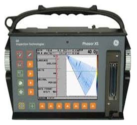
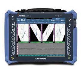
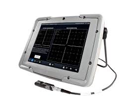
Ground Penetrating Radar’s Equipment
Ground-penetrating radar (GPR) equipment typically includes a control unit, an antenna, a power supply, and software for data acquisition and interpretation. There are several manufacturers that produce different types of GPR equipment, tailored to various applications and settings. Here are a few examples:
MALÅ (Guideline Geo) GPR Equipment: This Swedish company is a well-known manufacturer of GPR equipment. They offer a variety of systems, like the MALÅ Easy Locator HDR for utility detection, or the MALÅ GroundExplorer for more diverse geophysical and environmental investigations.
GSSI (Geophysical Survey Systems, Inc.) GPR Equipment: GSSI, based in the United States, is another prominent manufacturer. Their UtilityScan product is widely used for detecting and mapping subsurface utilities, while their StructureScan series is designed for concrete inspection and can detect rebar, conduits, post-tension cables, and voids within concrete structures.
Sensors & Software GPR Equipment: This Canadian company produces a range of GPR systems for different applications. Their Conquest system is designed for concrete scanning, while the LMX product line is used for utility location. They also offer systems like PulseEKKO and NOGGIN for broader geophysical applications.
IDS Georadar (part of Hexagon) GPR Equipment: IDS Georadar, based in Italy, provides GPR solutions for a range of applications, including utility detection, archaeology, and environmental assessment. Their Opera Duo system is a compact, easy-to-use system designed for utility location and shallow subsurface investigation.
Radiodetection GPR Equipment: Radiodetection, a UK-based company, manufactures the RD1500, a GPR system commonly used for utility detection. It features a variety of advanced features, such as the ability to estimate the depth of detected objects and the use of GPS/GNSS technology for precise positioning.
Remember that the choice of GPR equipment should be based on the specific requirements of your application, including the target depth, the size of the area to be surveyed, and the type of subsurface materials or features you are interested in. It’s also important to consider factors like the ease of use, portability, and the availability of technical support and training from the manufacturer.
Leave a Reply